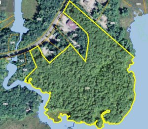
Birds Eye View of Property Line
The Moultonborough Falls Conservation Area is 37 acres. Its boundary starts along Route 25 in Moultonborough near the bridge that goes over the Red Hill River. It winds east, in and out of several commercial properties along Route 25 and appears again near the Magic Foods building. It extends behind Chippers (formerly Obsessions) and Ossipee Mountain Electronics. The property line follows the Red Hill River to Lees Pond and travels along the mud flats. You can see its directory listing on Google Maps at https://goo.gl/maps/mV75D3oLrH52
The land is hilly and rocky in spots, with wet lands and a few vernal pools in other spots. The shoreline along Lee’s Pond is marshy and goes out into mudflats. During times of high-water, there is water up to the property line. There are great views of the Ossipee Mountains and Red Hill. There are two footpaths that wind through the property.
Above is a working map of the property. You can zoom in or out and switch satellite view off or on.
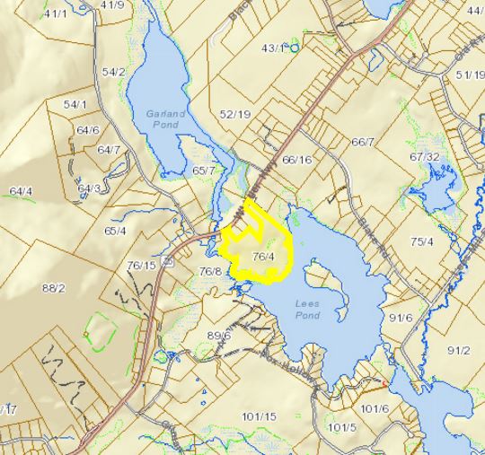
Lee’s Pond Preserve from the town’s GIS Map
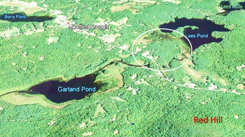
Here’s another view, looking south east from Red Hill, across Garland Pond towards the conservation area (circled), Lee’s Pond and Lee’s Mills, part of Lake Winnipesaukee. From this angle, you can better understand how keeping further development in this area can stem increases in nutrient loads on the lakes and maintain wildlife corridors and their habitat.